My excitement level was really high as we drove to the Crown Point Bridge on Thursday, May 29. I hadn't yet seen the new bridge, just opened in 2011. This is a truly strategic, historic location on Lake Champlain, and we'll come back here after the hike- there's lots to show you. But for today, it's "just" the place where we'll begin hiking east.

Officially, the North Country Trail still ends/begins at this bridge in New York. But, hopefully, a bill is being introduced in Congress this year that will add this Vermont extension to connect the trail with the Appalachian Trail. The new bridge has pedestrian walkways on each side. Here we go.

Once over the bridge we turned south, and had many chances to shoot lovely views of graceful span.

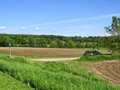
We had remained flexible in how to divide the hiking days up. There was a possibility of some trail over Snake Mountain, but our contact in Middlebury said they'd just had a bad storm and portions were seriously washed out, and it wasn't marked. So we chose the road walk around the base of the mountain. Here's the north end of the snake- we're actually headed for the south end, but this was the visible slope that we could keep in sight. That distinctive scarp was easy to keep track of.

Along the way we had a nice view of an osprey. It had a nest on a platform, but seemed pretty fond of the chimney cover on this house.

Finally, we got close enough to Snake Mountain that it was just a presence, not a distinguishable shape.

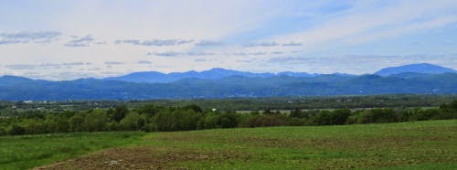
One of the strangest things, to me, was that this day was on a fairly level area between the Green Mountains (our destination), and the Adirondacks (some of my favorites). The Daks were a shock, every time I looked west where there was a break in the trees. This is one of the nicest views. I don't have much sense of the peaks from this angle, but I'm pretty sure the big hump in the back right is Giant which I have not climbed. I don't think you can even see Mt. Marcy (the highest peak) from this perspective because it's farther west. One of the peaks right near the middle is Dix, which Marie, Mathilda and I (and Chips) went over in 1996.
With a sunny day, some favorite mountains at my back, and new ones to be explored ahead of me, my soul was singing. Flowers were just the grace notes. Here are some wild geraniums.

We hiked 14 miles and arrived at the car, placed where the Trail Around Middlebury crosses Rt 23. Pavement is hard on the feet, but with all those miles we felt no guilt at ordering a yummy dinner! We got a BLT and a big salad and split them. The Bridge Restaurant, just on the Vermont side of the bridge, appropriately enough, is highly recommended. Good food, very reasonable prices.
So, this map isn't too exciting, but just for the record, here it is. It does show how relatively level this section is.

 | See We Hiked |
| if you like this blog, click the +1
| |
3 comments:
14 miles is a long hike. A nice looking area though and looks like you had excellent weather.
How often do you stop to rest on a hike like this or do you just go all the way with no breaks?
Your hiking reports are absolutely fascinating. Thanks for including the map!
Thank you for sharing your beautiful adventure with us! I love the shot of the osprey and the wild geraniums are so beautiful (they're blooming on my little acre right now).
Enjoy!
Post a Comment